
Sheep (1 of 40,000,000)
Here in Hong Kong the super markets carry these microwaveable meat pies from New Zealand. I think they're pretty good, but Annette kept insisting that they are probably better coming freshly baked from an oven. Well of course there was only one way to find out, so off we went.
As we were on our way, aboard an Air New Zealand 767, we realized that New Zealand isn't quite as close to Hong Kong as we thought it might be, despite the fact that they are seemingly on the same side of the planet. It turns out that New Zealand is not really close to anything. The day after Christmas, 11 hours after we departed HK, we arrived in Auckland.
Since NZ is the gateway to the Antarctic, we decided to check out Kelly Tarleton's Antarctic Encounter. This exhibition features historical information about the first explorers to the continent, plus a chance to see live penguins and sea creatures.
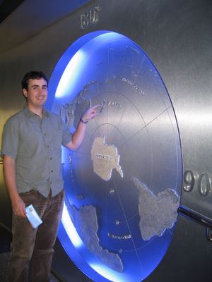
Ah, here we are (at Kelly Tarleton's in Auckland)
To see the penguins, we boarded 'Snow Cats' which took us on a little loop past the penguins and a couple of corny educational mock-ups. To demonstrate the Antarctic food chain, an animatronic Killer Whale snatched a fake penguin just outside the door of our 'cat'.
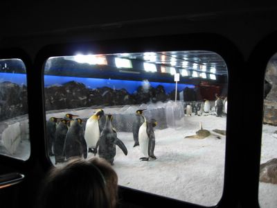
Penguins from the 'Snow Cat'
After seeing the penguins, we checked out the aquarium which contained sharks, rays, and assorted cold water fish. The thing that really got our attention was the crayfish tank.. It contained crayfish twice the size of Maine lobsters. Danged if we didn't forget to pack some Tony Chachere's.
Next stop was the Auckland harbor, where we took a little walking tour before having a wonderful NZ dinner of steak and grilled fish.

NZ Sailing Ship

Auckland Street
On day 2 we booked a tour to sights south of Auckland. The first stop was the Wai-O-Tapu Thermal Wonderland - a park where visitors can see geothermal features such as bubbling mud pools and geysers. We didn't see any geysers erupt while we were there, but we did see many interesting sights as we hiked through the park.

Pool at Wai-o-tapu - the red color is from iron deposits
Next we traveled to Te Puia - a Maori village where tourists can learn about Maori culture. We started off by trying out a Hangi meal - meats and local vegetables cooked by hot stones in an underground oven.

Traditional Maori meal
After lunch a Maori guide told us of the history of the settlement and took us on a tour of the surrounding grounds, which also had many geothermal features. The first Maori inhabitants used hot mud from mood pools to soothe their war-wounded bodies, and the mud is still being used for therapeutic purposes today.

Geyser at Te Puia
Next we learned about the continuing efforts at Te Puia to preserve Maori customs. At the village there is a workshop where students learn how to carve wood into traditional Maori displays that tell the history of their people. Historically these were vital to their culture because they had no written language to record historical events.
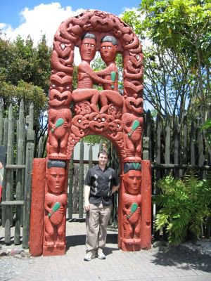
Carved Maori Archway
Our final stop on day 2 was the Waitomo Caves. First we entered the cave and learned about the formation of stalactites and stalagmites, but the feature attraction of the cave is the glow worm colony. Glow worms are the larval stage of a mosquito-like fly. Their bodies generate a bright blue light that attracts other insects, which they trap with web-like strings.
In the darkness of the cave, we boarded a small metal boat which the guide navigated through the cave so that we could view the glow worms. It was a breathtaking sight - reminiscent of the sky on a dark clear night.
On day 3, we went to the Auckland museum to view the collection of Maori artifacts and to watch some traditional Maori dances or 'hakas.' In the war haka, the performers made scary faces and stuck out their tongues to demonstrate how Maoris intimidated their enemies.

Maori performers

Aaah!
Leaving Auckland, we took an hour long flight to Christchurch on the south island. We didn't stay in Christchurch long, though.. we had a week to do a loop of the south island, so we immediately headed northward to Kaikoura. Many place names in New Zealand come from the Maori language and are descriptive terms to describe places.. Kaikoura means 'eat crayfish,' and these lobster-size crustaceans were in abundance at every eatery around.

East coast beach

Tunnels
We reached Kaikoura just before sunset and decided to check out the local seal colony.. we didn't get to see any seals close up on that day, but we were treated to some beautiful scenery.

Kaikoura seal colony

Annette discovers her inner Maori
On day 4 we were determined to see some of those seals close up, so we joined a seal swimming tour. Kaikoura is one of the few places where swimming with seals is possible (and safe) because most places that have seals also have large sharks that feed on the seals.
Thankful that we didn't have to worry about Jaws, we donned wetsuits, snorkels, and fins, and jumped into the water near the seal colony. Even with wetsuits the water felt quite cold for the first few minutes, but soon we forgot about our chills as three seals came to check out the strange invaders. The seals playfully swam around us... often floating upside just a few feet away from us before gracefully zooming away.

Where's the seal?

Seal flippers

Underwater Garden
Our next destination was the Marlborough region, where dozens of wineries are located. We enjoyed the views and we drove through the countryside, stopping at several wineries to sip sauvignon blancs, reislings, and pinot noirs.

Winery

Happy customer
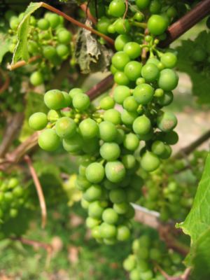
Not quite ripe
After we passed through the winemaking region, we toured some of the sounds on the northeast part of the island. The great thing about the New Zealand summer is that the days are very long. The sun rises around 6 and sets after 9, so we were able to pack a lot of sightseeing into each day.

Sound
After a long day of swimming with seals, tasting wines, and touring the coast, we reached Motueka, gateway to the Abel Tasman national park on the north west side of the island.
On day 5, we woke up early to do some kayaking with Kaiteriteri Kayaks. Our tour began with a water taxi ride to a beach deep in the park. Once there, our guide went over the basics of kayaking. (Of course we were already experts from our Alaska kayaking experience).
Annette took the front seat of the Kayak, with the job of setting the tempo and shouting out navigation orders to me in the rear, where I controlled the direction of the kayak with a foot-operated rudder. With our guide and a couple from England, we cruised along the beach and up into a river. We saw more seals, rock formations and lush vegetation.

Getting ready to Kayak

Kayaking in the river
After three hours of paddling, we found a secluded beach where we ate lunch. Our guide made us some hot cocoa and lattes. The temperature was somewhere in the high sixties.. just warm enough for Wes to take a swim in the cold water while Annette lounged in the shade. Annette would soon learn that hiding in the shade is not enough to protect yourself from the intense New Zealand sun.
The ozone layer over New Zealand is thinner than most parts of the world, and you can really feel your skin cooking whenever you are in direct sunlight - it is intense! Annette ended up with sunburnt legs and feet just from a few minutes of exposure.
After lunch we continuned our journey back to the beach where we departed from that morning. All in all we paddled over 18 kilometers - our arms were sore that evening!

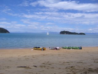
Our kayaks wait for us during lunch
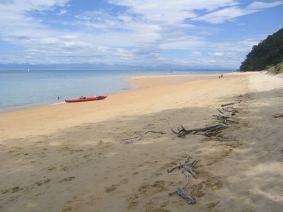
Abel Tasman beach
Leaving Motueka, we headed for Westport on New Zealand's west coast. On the way we stopped often to snap pictures of the scenic Buller Gorge.

Buller Gorge
Over the course of our trip we drove approximately 2,500 kilometers, so we got a good feel for what it is like to drive in New Zealand.
Some observations:
-Outside of the major cities, all of the roads are two lane. There are no autobahns or freeways.. although many of the locals think they are on the autobahn and sometimes pass dangerously, even if you are traveling at the posted speed (usually 100km/h).

Two-lane road?
-Sometimes even the two lane roads are only one lane. Most bridges are only built for one-way traffic, so you have to watch for drivers coming from the other way. There are signs telling you whether or not you have to yield to oncoming traffic. Occasionally even the train track shares the one-lane bridge.
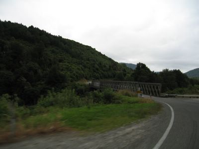
NZ Bridge
-And there is the fearsome NZ black-footed penguin that can strike at any time. When tourists stop for photos, the penguins attack, pecking out the tourist's eyes of before running away in their car (not really).

Watch for killer penguins
After a quick overnight stay in a Westport hostel, we set out for a drive down New Zealand's rocky west coast. As usual, we stopped often to take in the breathtaking scenery.

West coast islands

The faithful Nissan Sunny
One required stop on the west coast is the Punakaiki Pancake Rocks. These layered rock formations look like they are from another world. The pounding surf constantly (albeit slowly) erodes the formations and has even hollowed out tunnels to the surface. When a big wave rolls in, water sprays out in a big 'woosh!'.

Pancake rocks
Here's an especially 'dodgy' bridge one lane bridge that is shared by two lanes of traffic and the occasional train.

Scary bridge
Our next stop was Hokitika, an ex-gold rush town with a strip of touristy shops offering greenstone and wood carvings and other traditional handicrafts. Strangely, every shop in town (other than gas stations) shut down around 4:00 despite the fact that it was broad daylight until after 9pm. It looked like a scene from a zombie movie - an empty street with no people and hardly any cars.
Outside of town there was a beautiful lake at the base of the southern alps. We stopped to have a look at a waterfall before proceeding to a glacial river traversed by a suspension bridge. The river was bright blue due to 'glacier dust' - tiny particles of rock scraped off the mountainside.

Secluded waterfall

Glacial river
Late in the afternoon on New Year's Eve we arrived in Franz Josef. We spent the night in a cabin at glacier Cottages - probably the best place we stayed in NZ.

View from our cabin at Franz Josef
The village of Franz Josef consisted of tour companies and trendy restaurants. We selected a restaurant where we could sit outside and eat. Annette had steak, while Wes had to try some of the venison. In addition to sheep farms, there are many farms that have some sort of large deer that evidently don't jump very high, judging from the height of the fences. That lack of jumping might be what makes the deer extra tasty.
After dinner we returned to our cabin and watched the sun set on 2005. We watched a little bit of the Kiwi New Year's eve program on TV, which was quite funny, but we fell asleep before midnight. After all, we had a big hike ahead of us the next morning.

Goodbye, 2005!
On day 7 we headed into Franz Josef for a heli-hike on the glacier. The tour started with a 10 minute flight into the glacier valley, where the pilot took us for a close-up view of deep crevases before landing at a safer spot on the glacier.

Helicopter ride

Glacier below
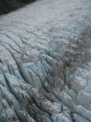
franz Josef Glacier
We got off the helicopter on a stable section of the glacier. Here our guide showed us how to strap on our metal boot spikes while telling us about the features of the glacier. The Franz Josef Glacier is one of the fastest moving glaciers in the world, sliding down the mountain at a rate of a meter or more per day. We could see and hear the effects of the movement; there were loud creaks and at one point we witnessed a bus-sized pillar of ice crumbling down far above us. All this is caused by heavy snowfalls on the Southern Alps. As moisture blows in from the Tasman Sea it encounters the Southern Alps. As the clouds rise, they dump rain on the western side of the mountains. Franz Josef gets about 5 meters of rain in a typical year, while places on the opposite side of the Alps receive significantly less.

Helicopter leaving us

Dangerous trek
As we hiked along, our guide pointed out interesting features. We came upon a tunnel that we were able to climb through. Inside we could really see the deep blue color of the glacier ice.

Annette explores

Awww
Hiking further, we came upon a pond of blue water. The guide told us that some of the more adventurous hikers go swimming there, but we decided against hopping in.
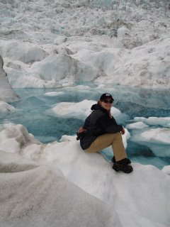
Glacier pond
The water on the glacier is (not surprisingly) safe to drink. Refreshing, too!
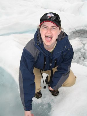
Natural slushee
After our two hour hike, it was time to head back down the mountain.

Time to go!
Departing Franz Josef, we headed south before heading back East to the middle of the island. This required us to cross the southern alps. The road through the mountains traversed roaring rivers and was dotted with countless spectacular waterfalls - all resulting from those heavy rains mentioned earlier.

Another waterfall
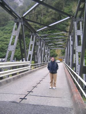
Annette blocking traffic

Rapids

Annette checks out yet another waterfall
After spending the night in Wanaka, we headed out to do some exploring on day 8. There are numerous hiking (or 'tramping,' as the Kiwis like to call it) trails near Wanaka, so we just drove around the countryside until we found one that looked promising. As the pictures show, the landscape here was totally different than on the West Coast, with gold grass covered mountains dotted with deep lakes and rock formations.

Amazing scenery

Baaah
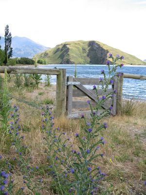
Lakeside

Deer ranch

Dramatic mountain
We finally settled on a trail and took a hike up to a mountain lake.

Hiking
Next we drove from Wanaka to Queenstown. Our route took us over another mountain pass, on which resides the highest paved road in NZ. At the summit is was windy and cold, so we didn't stay long!

Stream

Highest sealed road in NZ
On the other side of the mountain is Queenstown, the adventure capital of NZ, home of bungee jumping, jet boating, and other crazy pursuits.

Queenstown waterfront
Just a short drive from Queenstown is a hillside where several scenes from Lord of the Rings were filmed. We didn't realize it until we got there, but this area is also somewhat of a wildlife reserve where visitors can see and feed numerous kinds of animals. Annette started by feeding the sheep, which of course New Zealand is most famous for. Interestingly, there were no land mammals at all on New Zealand until European explorers introduced them in the 1800s.

Annette feeds the sheep...

and deer..

and?....

and goats....
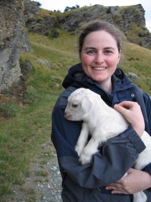
Annette makes a friend
Notable places from Lord of the Rings were signposted. We haven't re-watched the movie yet to see if we can recognize them.

Movie scene

aaah!
Another film was made in the area in the 80s.. evidently it was about an escape from a North Korean Prison. The prison set is still there, looking very out of place.

Movie set

Mini horse
At the top of the hill we were rewarded with views of the valleys below and the Remarkables mountain range, where skiers flock to in the winter. Evidently there can be snow there even in the middle of summer - we witnessed it falling while we were there.

Snow in the middle of summer?
The next day we hoped to take a jet boat ride, but decided against because it was rainy and unseasonably cold. Plus, the boat that we hoped to go on had caught on fire the previous day and was out of service. We were thankful we weren't on the boat at the time.. it would not have been fun to go overboard into an ice-cold stream.
We settled on another day of touring; we headed further East to the coast. We passed by gorges, golden hills, and huge bright blue lakes.

More LOR fans..

Wildflowers

Another gorge
Here Annette was hoping to take a 'postcard' photo of the southern alps reflected in this blue lake.. unfortunately mother nature had other ideas. Oh well, at least we got to see some rainbows.

See the mountains?

Rainbow
Our destination for day 8 was Akaroa, a town situated in the crater of an ancient flooded volcano (now extinct). As we were driving along a little after 6, we realized that the Nissan Sunny was down to less than a quarter of a tank and unfortunately there were no large towns nearby. In every small town we passed, the gas station was closed for the evening (evidently 24hr pay-at-the-pump stations haven't caught on in New Zealand). The fuel tank needle continued to dip further and further.. resting just above 'E', with another 30km to cover until Akaroa. The only problem was that we had to climb the outside rim of the volcano before descending into the crater where Akaroa is located. We crossed our fingers and continued up the mountainside while the gas warning light flickered on and off. Finally we reached the summit where the bay stretched out before us. No stopping for pictures, though, as we coasted down the other side towards Akaroa. In the end we did make it and luckily reached the gas station in Akaroa 5 minutes before it closed.
That night we ate at a restaurant on the shoreline and watched a rainbow form just as the sun was setting.

Rainbow at dusk
The next day we had planned on swimming with the harbor dolphins in Akaroa, but our plans were interrupted by less than ideal weather and the fact that the tour operators couldn't find the dolphins. So, we strolled along the downtown area shops. Akaroa has a decidedly French flavor - it was originally settled by the French and many of the decedents of the original settlers still reside there.

Akaora lighthouse

Akaora scenery
Departing Akaroa we headed for Christchurch, which is often compared to England because of it's architecture, gardens, and the 'punting' boats that carry passengers along the calm river that goes through the city.
We started off by taking a tour of the arts center, then the Christ Church Cathedral, and finally the botanical garden.

Christchurch art

Christchurch

Millenium sculpture in Christchurch

Maori Lord's Prayer in cathedral
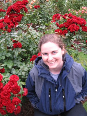
Annette stops to smell the roses
The next morning was our last in New Zealand for this trip - we got to the airport early, caught a plane to Auckland, and another all the way back to Hong Kong.
We thoroughly enjoyed our time in New Zealand and have already started planning what we want to see on our next visit, whenever that may be.
